KeralaWayanad Landslide Update: Rescue Operation Underway, 308 Dead
The army is utilizing thermal scanning to locate human presence in the disaster-stricken Wayanad region, following the massive landslides that happened on July 30. In addition, ISRO also released details about the massive landslides.
Thermal Scanning:
These thermal scanning capable of detecting human presence within a 12-meter range, have revealed very minimal active human presence in the affected areas.
The Kochi-based agency conducted a drone inspection at the request of the district administration, and the findings from the thermal imaging report have been delivered to the local authorities.
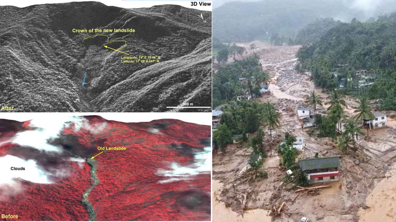
ISRO Findings:
In addition, ISRO has provided vital information regarding the origin of the Mundakai landslide. The epicenter of the landslide is located at 1550 meters above sea level, with the displaced water and debris extending up to eight kilometers from the source.
The total affected area spans approximately 86,000 square meters, with ISRO releasing radar satellite images to assist in understanding the extent of the disaster.
Zone Divisions:
Today, search operations are being conducted by 40 teams across six designated zones:
- Zone 1: Punchirimattom region
- Zone 2: Mundakkai region
- Zone 3: School area
- Zone 4: Chooralmala town area
- Zone 5: Village area
- Zone 6: Downstream
Of these, 10 Army teams have been assigned to search and rescue operations in Zones 1, 2, 3, 5, and 6. Despite ongoing rescue efforts, the death toll in Wayanad has unfortunately risen to 308.